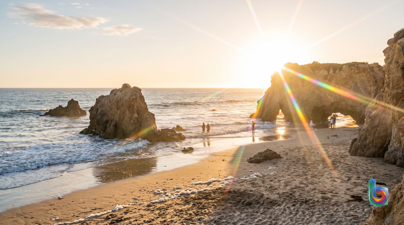
Season by season
December-February
The quietest stretch, with cool water, short days and a real chance of rain, high surf and storm-related road or trail disruptions. It can be excellent for dramatic wave watching and winter whale watching, but it is not dependable swimming weather.
Storms can affect PCH and canyon trails; beach days are weather-dependent and the Pacific is cold.
March-April
A changeable shoulder season: some bright, mild beach days, but cool marine air and unsettled weather remain possible. Crowds and parking are generally more manageable than in summer, particularly on weekdays.
Do not plan around guaranteed sun or warm-water swimming; check trail and road conditions after rain.
May-June
Pleasant and relatively uncrowded compared with high summer, but often affected by the low cloud and fog known locally as June Gloom—especially in the morning. Afternoons can improve.
Morning gray skies are common, and it may not deliver the classic all-day sunny beach holiday visitors expect.
July-August
The most reliably beach-oriented period, with the strongest odds of warm, sunny weather. It is also Malibu at its most congested: PCH traffic and limited legal parking can dominate the day, especially on weekends.
Expect the worst traffic, crowded beaches and difficult parking. A car still helps, but it is not a cure for summer-weekend gridlock.
September-November
Malibu's best overall window: the ocean retains summer warmth, skies are often clearer after the marine-layer season, and weekday pressure eases once schools reopen. September can still feel like summer; later autumn is quieter.
Autumn heat and Santa Ana wind can bring wildfire risk and access changes. Check current PCH, beach and park status before leaving.
Getting around
Rental car / driving
The default for nearly everyone: beach-hopping, families, canyon hikes and any stay west of Civic Center. It is especially useful for Point Dume, Paradise Cove, Zuma & Trancas, and Western Malibu & Leo Carrillo, where sights spread well beyond PCH stops.
Treat Pacific Coast Highway/CA-1 as Malibu’s single spine and plan one coast sector per day: Getty Villa/Malibu Pier/Carbon Beach in the east, or Point Dume/Zuma/Trancas in the west. Read parking signs closely, use legal lots, and arrive early for beaches on weekends.
A car does not beat summer-weekend PCH traffic, and beach parking is scarce and aggressively regulated. Canyon roads around Malibu Canyon, Serra Retreat, Corral Canyon and Latigo are narrow and winding; never assume short map distances mean quick drives.
Metro bus (Line 134)
Budget travelers with light luggage staying near PCH, particularly around Malibu Pier, Surfrider and Civic Center. It can connect Malibu with Santa Monica and is workable for one fixed beach or meal stop.
Use Metro Line 134 along PCH and check the live schedule before committing; there is no rail in Malibu. Build in substantial time and choose accommodation close to a corridor stop rather than assuming every beach entrance is nearby.
This is slow, limited and schedule-dependent—not a practical beach-hopping system. It stops working well beyond the highway: Malibu Canyon and Serra Retreat have a major last-mile gap; Point Dume, Paradise Cove, Zuma & Trancas, and especially Western Malibu & Leo Carrillo remain spread out from stops. Late-night service is not a plan.
Rideshare / taxi
Car-free visitors making a short hop around Civic Center, Malibu Pier, Surfrider, Carbon Beach or eastern Malibu, or for a one-way trip from LAX when renting a car is not worthwhile.
Book through the usual ride-hailing apps, and arrange a return before heading to an isolated beach or trail. It is most realistic for restaurant, hotel and pier-area trips rather than a full day of scattered sights.
Fares rise quickly and return cars become less dependable the farther west you go. Point Dume, Zuma & Trancas and Western Malibu & Leo Carrillo are poor places to assume an easy late-afternoon or late-night pickup; cell service and traffic can compound the wait.
Walking
Short local links only: Malibu Pier, Surfrider and Civic Center are the closest thing Malibu has to a walkable cluster. Some Carbon Beach addresses are also within a longer roadside walk of the pier area.
Walk within one immediate destination area, use signed public beach-access paths, and carry water and sun protection. At rocky coves, time the beach route around tide and surf.
There is no compact Malibu center and PCH is not a safe or pleasant cross-town promenade: fast traffic, narrow shoulders and missing pedestrian infrastructure make inter-beach walking a bad idea. It fails particularly badly between Corral Canyon, Latigo and Escondido, around Point Dume access roads, and in canyon districts after dark.
Cycling
Confident road cyclists who deliberately want a PCH ride and are prepared to treat it as a traffic-exposed recreational route, not as casual sightseeing transport.
Ride only in daylight, use high-visibility gear, and keep the plan simple rather than trying to link multiple beach access points. A bike can help around a single base, but it does not solve Malibu’s distance problem.
For most visitors, Malibu is not bike-friendly: PCH has fast traffic and often narrow shoulders, while beach access roads and canyon routes add hills and difficult conditions. It is particularly impractical for casual riders around Malibu Canyon, Serra Retreat, Corral Canyon and Latigo, and is not a safe late-night alternative.
Safety: Drive PCH defensively and never walk its narrow shoulders; at beaches, use signed public access, obey parking signs, and check surf, tides and any fire- or storm-related closures before setting out.
Book before you land
Getty Villa — admission is timed and reservation-only, although admission itself is free; reserve as soon as your date is firm, especially for weekends and holidays, and reserve parking if arriving by car. This is the one Malibu-area cultural stop worth treating as a real advance booking. · Nothing else in Malibu reliably “sells out” as an attraction. The constraint at Point Dume, Zuma, El Matador and the other beaches is legal parking, not tickets: arrive early on weekends rather than paying a reseller or booking a dubious beach tour.
- Malibu is not a resort town with a public boardwalk. Most beach access is through signed public paths, state-beach lots or coastal access points; use them and do not cut through private driveways, gates or beachfront property.
- Parking rules are aggressively enforced and spaces are deliberately scarce. Read every sign, avoid stopping on PCH shoulders, and have a backup beach rather than circling until midday.
- Build plans around the coast’s geography: east Malibu/Malibu Pier and the Getty Villa are one day; Point Dume, Zuma, Westward and El Matador are another. The map makes them look close; PCH traffic says otherwise.
- The Pacific is not a hotel pool. Watch for rip currents, surf and high tides, especially at rocky coves such as El Matador; do not turn tidepooling into a gamble with the return route.
- Bring water, sun protection and a charged phone for hikes. The Santa Monica Mountains get hot quickly, and canyon trail conditions can change after storms or fire activity.
- Do not come expecting celebrity-spotting access. The useful Malibu experience is public coastline, surf, canyon trails and the Getty Villa—not trying to find private homes.
Worth leaving the city for
Channel Islands National Park (via Ventura Harbor)Full day — realistically 10–12 hours door-to-door from Malibu, including the drive to Ventura Harbor, ferry check-in and crossing.
This is the one genuinely transformative escape: boat access to wild, largely roadless islands, sea caves, cliffs and hiking rather than another developed Southern California beach. It beats a second or third Malibu beach day decisively, but only in settled weather and with a firm plan; it is not a casual add-on.
Santa BarbaraFull day — about 1.5–2 hours each way by car from central Malibu in favorable traffic; allow longer on weekend afternoons.
Go when you want an actual walkable coastal town: the Mission, Funk Zone, State Street, harbor and a far deeper food-and-wine bench than Malibu’s thin, car-dependent strip. It is more satisfying than lingering around Malibu Pier after you have done the beaches and Point Dume. The downside is that the 101 drive can be punishing at peak times.
OjaiFull day — roughly 1.5–2.5 hours each way by car, depending on where in Malibu you start and traffic.
Ojai is the useful antidote to the coast: a small valley town with orange groves, mountain views, galleries and a slower inland rhythm. Choose it for an easy, low-key reset, not for blockbuster sights; if you have not yet done Malibu’s best beach and cliff walks, stay in Malibu instead.
Santa MonicaMost of a day — typically 35–60 minutes each way by car from eastern/central Malibu, but much longer in Pacific Coast Highway traffic; bus service is possible but slow.
Malibu has the scenery; Santa Monica supplies what Malibu conspicuously lacks: a walkable commercial core, bike-friendly beachfront, museums, restaurants and the pier. It is touristy and the pier is not subtle, but it is a better use of a day than trying to make scattered Malibu stops cohere without a car.